The swathe of historical destruction cut by Rochester’s highway system is a repeat theme in any publication about Rochester history. I wrote before of a quaint Third Ward corner, Mogridge Court, which met its fate in favor of Inner Loop extension. That theme is not only prevalent in Rochester but echoes through much of the United States; the struggle and tension between the dense, cluttered neighborhoods of the past with the automobile-centered asphalt deserts of the future was ongoing in every city founded prior to the debut of the motor-car. Pedestrian- and horse-centric cities were finding their narrow brick and cobble streets choked with auto traffic and city centers were filling up with exhaust fumes.
Given the situation it seems all too simple to say well, widen the streets. And when the streets are widened and the cars are running smoothly, the pedestrians are removed from the streets. But congestion builds up anew; well then, add more lanes! The lanes are added and the streetcars are removed to make the space. But congestion builds up again! So what we need is a very large, very fast road that connects all the places people want to get to. But what happens when the places people “don’t” want to drive to are in the way–and where people still lived?
This entry goes into the cozy gated neighborhood of Centre Park, long lost to the expansion of Rochester’s highways. It also goes on to explore nearby Centre Square, a pleasant village green taken over by trains. All of it is gone now, replaced by pavements and retaining walls and gravel banks–but that won’t stop us from revisiting it textually. Let’s go!
Centre Park
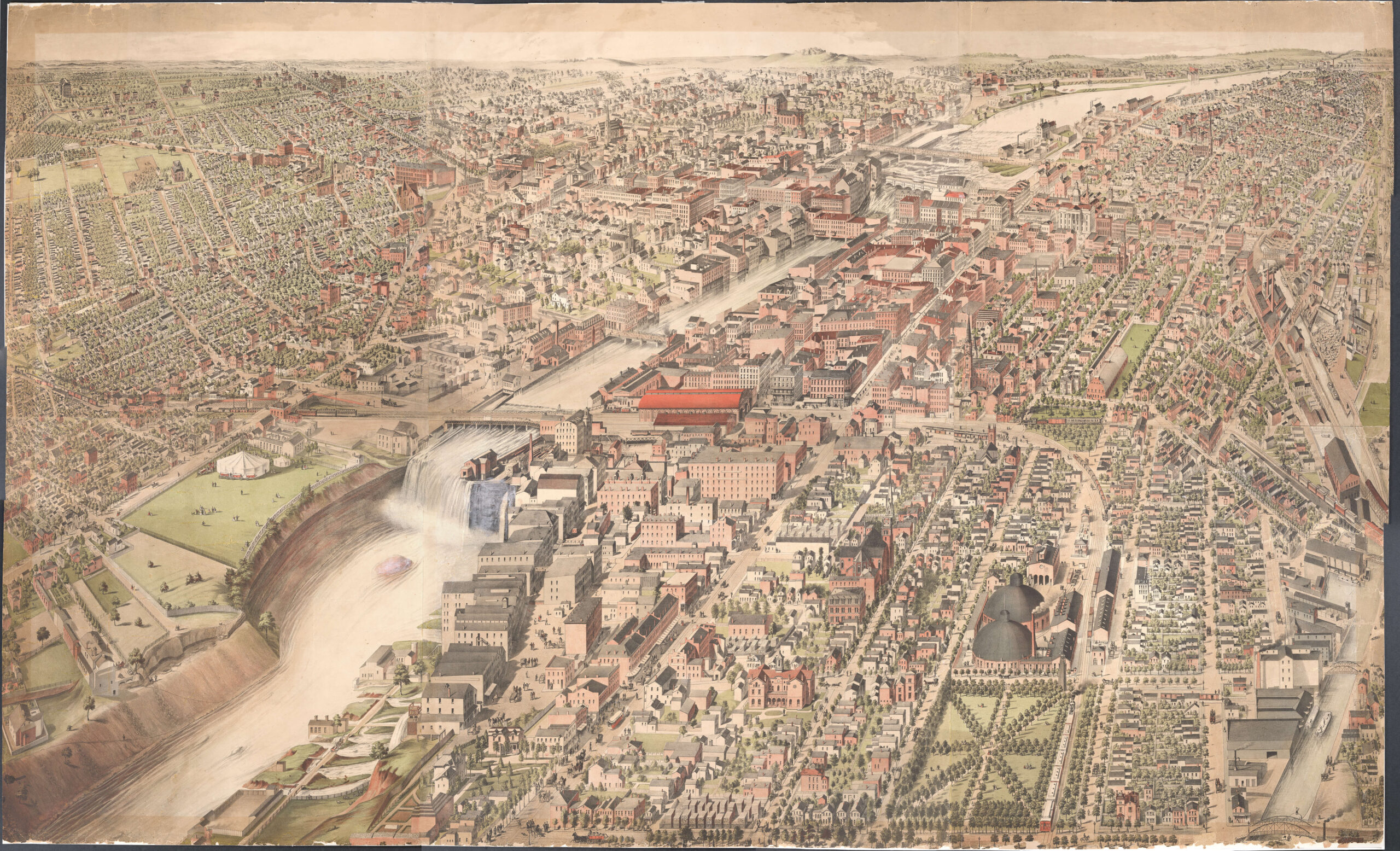
Settlement of Centre Park began when the City of Rochester was Rochesterville, early in the 19th century.

Red: Centre Park.
https://www.loc.gov/resource/g3804r.ct005821/?r=0.198,0.364,0.23,0.139,0

Red: Centre Park.
https://photo.libraryweb.org/rochimag/rpm/rpm00/rpm00448.jpg

Red: Centre Square.
Green: Centre Park.
https://rochesterhistory.rit.edu/wp-content/uploads/2024/03/Rochester-Map-Medium-Res-1-1-scaled.jpg

What “remains” of Centre Park: basically just the name.
My curiosity was piqued regarding Centre Park when I came across the below article, wherein a reporter visits the little pocket neighborhood of Centre Park and describes some of its early and then-present history:


Sunday, June 16, 1889
The article goes on to describe, in loving detail, the houses of the neighborhood, beginning with No. 43 Elizabeth Street:
No. 43 Elizabeth Street
The Bemis property was a rambling cottage that was added to constantly as need required; as the article puts it, “like Topsy“.
It served as the home of Samuel Bemis from his arrival in Rochester in 1822, until his death in 1888.

Sunday, June 16, 1889

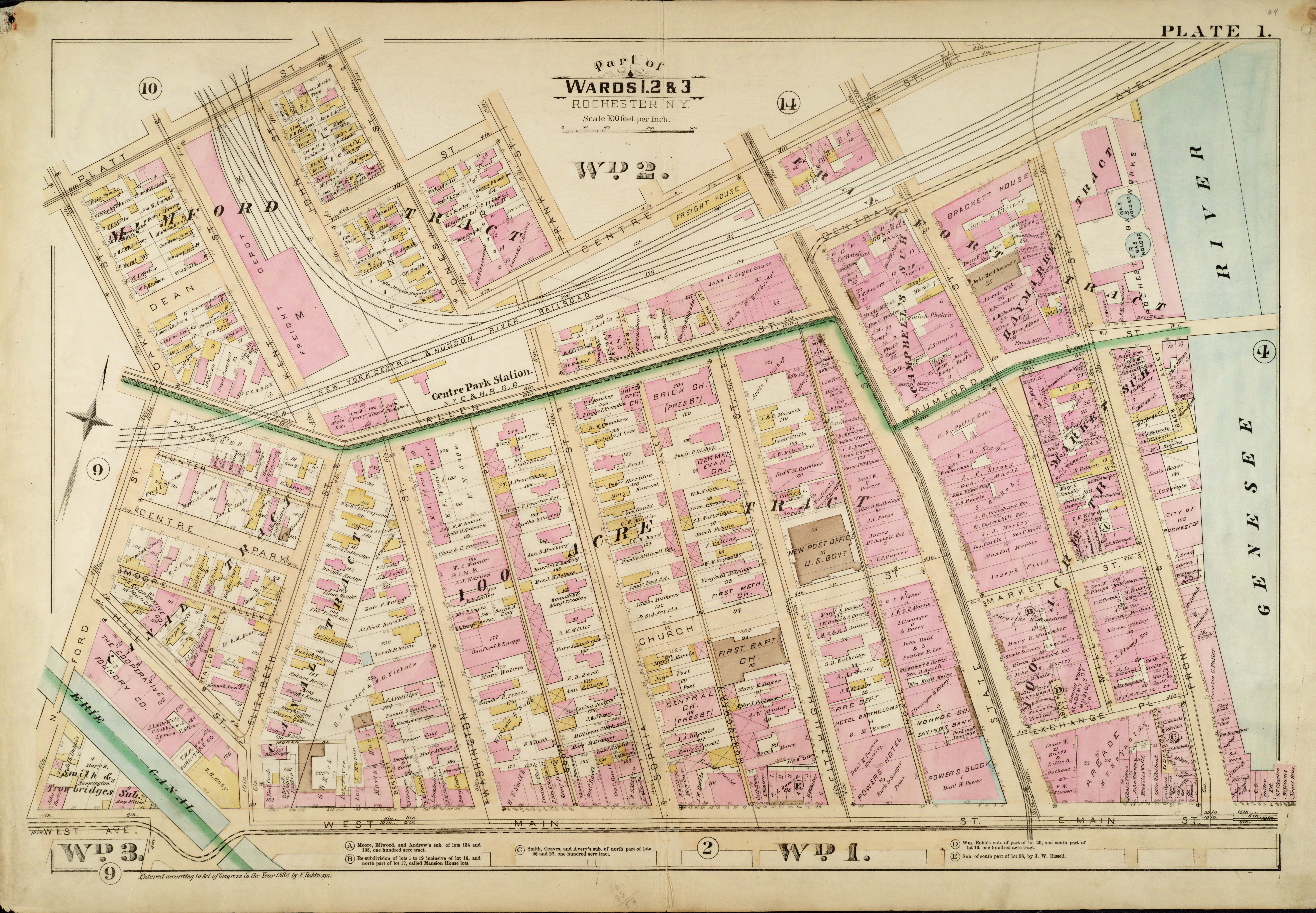
Red: Samuel Bemis household, Centre Park.
https://photo.libraryweb.org/rochimag/rpm/rpm00/rpm00127.jpg

Red: Samuel Bemis household, No. 43 Elizabeth Street and No. 1 Centre Park.
https://photo.libraryweb.org/rochimag/rpm/rpm00/rpm00242.jpg

Saturday, June 07, 1884
https://www.newspapers.com/article/democrat-and-chronicle-samuel-bemis/165303775/

Thursday, May 03, 1888
https://www.newspapers.com/article/democrat-and-chronicle-samuel-bemis/165301653/

Grave of Samuel Bemis in Mt. Hope Cemetery.
https://www.findagrave.com/memorial/7623923/samuel-bemis
In 1899, the Bemis family name would be applied to the alley previously called Moore Alley.

Scenic Bemis Alley in present day.
No. 1 Centre Park
Also on the Bemis parcel was No. 1 Centre Park, a two-story grey brick house covered in vines.

Sunday, June 16, 1889
No. 1 Centre Park was once home to a packet-boat captain, Harry Dickey;

https://www.google.com/books/edition/Daily_American_Directory_of_the_City_of/N5ZQAAAAYAAJ?hl=en&gbpv=0
Captain Harry Dickey was captain of the packet boat “Phoenix”; he was called out in the 1839 Rochester Freeman as having been abusive to a Black deacon, Stephen Henry Gloucester, who was passenger on his packet; Captain Dickey allegedly dragged Gloucester from the dining table, across the deck, and exacted extra passenger fees from him before ejecting him onto the bank of the canal.

Wednesday, September 25, 1839
https://www.newspapers.com/article/the-rochester-freeman-captain-dickeys-a/166278939/
Dickey wrote in his own defense, downplaying violence and epithets on his behalf, but it still doesn’t really hold water. Dickey keeps bumping up against the reason Gloucester could not be seated, saying something about “other passengers coming through” but not really expounding on that. All I can imagine is that he somehow sat in a seat that blocked every other passenger from reaching the dining table, and refused to recognize that fact or move, which seems unlikely.


Wednesday, October 09, 1839
https://www.newspapers.com/article/the-rochester-freeman-to-the-public-by-h/166280093/
The victim’s friend, Charles Calistus Burleigh, wrote with his own version of events, which did not reflect well upon Captain Dickey. Warning, a slur is used, quoted from Dickey’s lips.


Wednesday, November 06, 1839
https://www.newspapers.com/article/the-rochester-freeman-friend-whittier/166280984/

https://en.wikipedia.org/wiki/Charles_Burleigh
https://www.findagrave.com/memorial/38896061/charles-calistus-burleigh
Harry Dickey was the brother of David Dickey, who lived at No. 3 Centre Park, next door to Harry.

The grave of Harry Dickey and family in Mt. Hope Cemetery.
https://www.findagrave.com/memorial/32060018/harry-dickey
No. 53 Elizabeth Street

No. 53 Elizabeth Street, on the corner opposite Centre Park from the Bemis house, was a stone house with a brick addition, and the home of Samuel F. Witherspoon.


https://www.libraryweb.org/rochcitydir/images/1888/1888t-z.pdf

Red: Home of Samuel F. Witherspoon.
https://photo.libraryweb.org/rochimag/rpm/rpm00/rpm00127.jpg

Red: Home of Samuel F. Witherspoon.
https://photo.libraryweb.org/rochimag/rpm/rpm00/rpm00242.jpg

Red: No. 53 Elizabeth Street.
https://www.loc.gov/resource/g3804rm.g3804rm_g06217189203/?sp=6&r=0.268,0.247,0.372,0.209,0

Monday, February 11, 1901
https://www.newspapers.com/article/democrat-and-chronicle-obituary-for-samu/171333079/

Grave of Samuel F. Witherspoon in Mt. Hope Cemetery.
https://www.findagrave.com/memorial/131397429/samuel-f-witherspoon
No. 2 Centre Park
No. 2 Centre Park was purchased by Dr. Parson Genet Shipman, a physician, around 1836.


His new address first appears as “Park Place” in the 1838 directory, but it’s Centre Park:

https://www.libraryweb.org/rochcitydir/images/1838/1838p-z.pdf
In the 1841 directory, the address is given as No. 2 Centre Park.

https://www.libraryweb.org/rochcitydir/images/1841/1841p-z.pdf

Red: Physician’s office of Dr. Shipman, Exchange Street.
https://photo.libraryweb.org/rochimag/rpm/rpm00/rpm00448.jpg

https://www.libraryweb.org/rochcitydir/images/1870/1870r-s.pdf
Dr. P. G. Shipman died January 19th, 1871, and his heirs took possession of the house. Dr. Shipman’s widow, Elizabeth L. Way, would continue living there, and remarry in 1876.

https://www.newspapers.com/article/democrat-and-chronicle-p-g-shipman-obi/165339362/

Grave of Dr. Parson G. Shipman at Mt. Hope Cemetery.
https://www.findagrave.com/memorial/41361584/parson-genet-shipman

Red: No. 2 Centre Park, the old Shipman homestead.
https://photo.libraryweb.org/rochimag/rpm/rpm00/rpm00127.jpg
In 1876, Shipman’s widow Elizabeth L. Way married Sheriff Joseph B. Campbell. Campbell would die 1891, leaving Elizabeth once again widowed.

Wednesday, April 01, 1891
https://www.newspapers.com/article/democrat-and-chronicle-joseph-b-campbel/171268750/
Dr. Parson G. Shipman had a son, Henry D. Shipman, who left Rochester for New York City. In 1887 Henry Shipman was charged with the murder of his landlady, Josephine Wilkin Mason. Alienists examined him and pronounced him too insane to stand trial. Henry Shipman would spend the next twenty years in brutal mental asylums. After being found sane, Henry Shipman was transferred to the Tombs in 1907 for retrial.

https://www.newspapers.com/article/democrat-and-chronicle-henry-shipman-cal/166345914/

Red: No. 2 Centre Park, N. B. Richardson.
https://photo.libraryweb.org/rochimag/rpm/rpm00/rpm00242.jpg
“N. B. Richardson” of No. 2 Centre Park on the above 1888 map was Norman Brewster Richardson from Warren, Illinois. He was the uncle of Elizabeth L. Way, or of P. G. Shipman. To be honest, I’m not sure how the Richardsons are related to the couple. It seems the property was in his name at this point.
Richardson died 1890.

Thursday, September 06, 1888
https://www.newspapers.com/article/democrat-and-chronicle-n-b-richardson/171271428/

Red: No. 2 Centre Park.
https://www.loc.gov/resource/g3804rm.g3804rm_g06217189203/?sp=6&r=0.268,0.247,0.372,0.209,0#
The Shipmans would live at No. 2 Centre Park until 1892-1893;

E. L. Campbell = Elizabeth L. Way Shipman Campbell
A. B. Shipman = Azariah Booth Shipman, possibly a nephew? Named for Parson’s brother, Azariah Booth Shipman.
Sarah E. Shipman = Sarah Eastman Shipman, daughter of Parson and Elizabeth.
Elizabeth Shipman = Not sure, actually. Parson G. Shipman had daughters Eleanor and Eliza, but Eliza wasn’t apparently an Elizabeth.
https://www.libraryweb.org/rochcitydir/images/1892/House_Directory_1892.pdf
After that last year, Elizabeth L. Way would move to No. 28 Peart Place. The house would become property of a druggist, Louis Wyeth, his wife Florence Abby Rogers, and children. Wyeth left for Bayard, Nebraska in 1905. His son, John Louis Wyeth, also a druggist and recently-bankrupted, lived at Centre Park one additional year before following his father to Nebraska.
Louis Wyeth, according to his wife’s 1956 obituary, died in 1924. I cannot locate an obituary or a grave for him.
Elizabeth L. Way [Shipman, Campbell] would die October 18th, 1909.

Wednesday, October 20, 1909
https://www.newspapers.com/article/democrat-and-chronicle-obituary-for-eliz/171269497/

The grave of Elizabeth L. Way at Mt. Hope Cemetery.
https://www.findagrave.com/memorial/8850572/elizabeth_l-shipman
Curiously, Elizabeth’s marriage to Joseph B. Campbell went unmentioned by both obituary and grave.
No. 3 Centre Park
No. 3 Centre Park was a two-story frame house with a gabled roof and a “broad hospitable verandah” that was, as of 1889, the home of “Deacon” David Dickey. Dickey’s interests were highly entwined with the Brick Church; though he was never actually a deacon, his presence as an elder at the church since 1833 or 1838 earned him the affectionate nickname. David Dickey did preach, beginning in 1851.
For a period of time, David Dickey served in a missionary capacity on the canal, preaching gospel to the boatmen on the packets in hopes of turning them to a righteous life. This earned him the title of “Canal Missionary” in the directory.

https://www.google.com/books/edition/Daily_American_Directory_of_the_City_of/N5ZQAAAAYAAJ?hl=en&gbpv=0

Red: No. 3 Centre Park, home of “Deacon” David Dickey.
https://photo.libraryweb.org/rochimag/rpm/rpm00/rpm00127.jpg

Red: No. 3 Centre Park, home of “Deacon” David Dickey.
https://photo.libraryweb.org/rochimag/rpm/rpm00/rpm00242.jpg
“Deacon” David Dickey’s address is misidentified as No. 4 Centre Park in his obituary, instead of No. 3. That’s “Cross” the street. Get it?

https://www.newspapers.com/article/democrat-and-chronicle-obituary-for-davi/165448239/

The grave marker of David Dickey and wife Minerva Wilcox in Mt. Hope Cemetery.
https://www.findagrave.com/memorial/32060017/david-dickey
No. 5 Centre Park
No. 5 Centre Park was a wooden cottage without a tenant at the time of this 1889 publication. It was known to the neighborhood as the “old Burr place” after two brothers who had lived there until their death in the cholera outbreak of 1832.

My research confirmed that Major Albert Chapin Burr died of cholera on August 19, 1832, apparently after having volunteered as a nurse for the choleric;
In this village, on Sunday last, of malignant cholera, Major Albert C. Burr, aged 27 years. Among the many melancholy deaths from the pestilence with which we are now afflicted, none has produced a deeper sensation than that of this estimable young man. From the vigor of health and youth, in a few hours he passed to the tomb. As an industrious and worthy citizen, an amiable and pious Christian, an affectionate brother, a kind and dutiful son, and an honest man, he was universally respected and beloved, and will long be remembered.
Anti-Masonic Enquirer
August 21st, 1932

https://www.newspapers.com/article/democrat-and-chronicle-albert-c-burr/165373037/
Evidence of a brother who also died of cholera in 1832 is less forthcoming; one brother, Alexander J. Burr, died in 1838. However, Albert’s father and mother, Timothy Burr and Mary Chapin Burr, both died of cholera August 30th, 1832.

The Burr family grave plot in Mt. Hope Cemetery.
https://www.findagrave.com/memorial/210758508/albert-chapin-burr
At the time of the 1875 Atlas No. 5 was the home of Edwin Sornborger, his wife Mary Maria Dibble, and their children.

Red: No. 5 Centre Park.
https://photo.libraryweb.org/rochimag/rpm/rpm00/rpm00127.jpg

https://www.libraryweb.org/rochcitydir/images/1875/1875r-s.pdf
At the time of the 1888 Plat Map No. 5 was the home of Joseph H. Fisher. Despite the name being prominently displayed on the map, I can’t find him in the 1888 directory, or any ones near it. There are no Joseph Fishers, and there are several Joseph Fischers who don’t have a Centre Park Address.

Red: No. 5 Centre Park.
https://photo.libraryweb.org/rochimag/rpm/rpm00/rpm00242.jpg
No. 5 Centre Park was the address given for “Madame Blanche Sanguay, gypsy”, a fortune teller advertising in the Democrat & Chronicle.

Tuesday, March 28, 1899
https://www.newspapers.com/article/democrat-and-chronicle-madame-blanche-sa/166356699/
No. 7 Centre Park
This was the long-time home of Jeremiah Cutler, long-time former Deputy County Clerk for Monroe County. He was apparently a very fastidious, conservative gentleman, who took to routines and kept to them unfailingly.

Sunday, June 16, 1889

Red: No. 7 Centre Park, home of Jeremiah Cutler.
https://photo.libraryweb.org/rochimag/rpm/rpm00/rpm00127.jpg

Saturday, January 13, 1883
https://www.newspapers.com/article/democrat-and-chronicle-obituary-for-jere/165357511/

Grave of Jeremiah Cutler in Mt. Hope Cemetery.
https://www.findagrave.com/memorial/33820611/jeremiah-cutler
Into the house would move Louis Orange McKinney and family:

Red: No. 7 Centre Park, former Cutler home, now home of Louis O. McKinney.
https://photo.libraryweb.org/rochimag/rpm/rpm00/rpm00242.jpg

https://www.libraryweb.org/rochcitydir/images/1888/1888m-q.pdf
For uncertain reasons, Louis O. McKinney’s address was given as No. 5 instead of No. 7 Center Park in an obituary:

Thursday, April 26, 1888
https://www.newspapers.com/article/democrat-and-chronicle-louis-o-mckinney/165453690/

Sunday, April 29, 1888
https://www.newspapers.com/article/democrat-and-chronicle-louis-o-mckinney/165453574/
Louis Orange McKinney was buried in Mt. Hope Cemetery; I do not have an image of his grave yet: https://www.findagrave.com/memorial/40884530/louis-orange-mckinney.
No. 9 Centre Park
No. 9 Centre Park was a brick house built by Orlando Hastings, and occupied by the Fenn family.

Sunday, June 16, 1889
According to the article, No. 9 Centre Park was built for attorney Orlando Hastings. This is first listed as his address in the 1847 directory, meaning it must have been built sometime around then.

https://www.libraryweb.org/rochcitydir/images/1847/1847d-h.pdf

Red: No. 9 Centre Park, home of Harvey C. Fenn and family.
https://photo.libraryweb.org/rochimag/rpm/rpm00/rpm00242.jpg

https://www.libraryweb.org/rochcitydir/images/1888/1888e-g.pdf
Harvey Curtis Fenn was a cabinet-maker; he arrived in Rochesterville in 1822 and was one of the names in the first city directory in 1834. He lived on North Fitzhugh Street until 1869, when he sold his home to the Baptist Church and moved to No. 9 Centre Park. He was married to Mary Ann Colson.

https://www.libraryweb.org/rochcitydir/images/1834/1834d-h.pdf
For forty years Fenn was in business with William Brewster as Brewster & Fenn.

Saturday, December 18, 1875
https://www.newspapers.com/article/democrat-and-chronicle-william-brewster/35341990/

https://www.google.com/books/edition/Daily_American_Directory_of_the_City_of/N5ZQAAAAYAAJ?hl=en&gbpv=0
Brewster died January 17th, 1875; Fenn continued on in the cabinetry business solo.

Red: Nos. 105-107 State Street, business of Harvey C. Fenn.
https://photo.libraryweb.org/rochimag/rpm/rpm00/rpm00126.jpg
The obituary of Harvey C. Fenn misidentifies his address as “9 Culver Park”. Rest assured, he died at No. 9 Centre Park! I know you were probably stressed by the discrepancy.

Wednesday, June 15, 1887
https://www.newspapers.com/article/democrat-and-chronicle-harvey-c-fenn-9/166231646/

Graves of Harvey C. Fenn and wife Mary Ann Colson at Mt. Hope Cemetery.
https://www.findagrave.com/memorial/100122582/harvey-curtis-fenn
https://www.findagrave.com/memorial/32011733/mary_ann-fenn
Harvey C. Fenn’s son, William Wisner Fenn, would die just under five years later of consumption, his health apparently worsening after his father’s death. Fun fact, he was named for Rev. William Wisner, pastor of the Brick Church beginning in 1831.

https://www.libraryweb.org/~digitized/books/Living_church.pdf

Wednesday, June 01, 1892
https://www.newspapers.com/article/democrat-and-chronicle-william-w-fenn/166231696/

Grave of William W. Fenn at Mt. Hope Cemetery.
https://www.findagrave.com/memorial/32011735/william-wisner-fenn
No. 11 Centre Park
No. 11 Centre Street didn’t quite fit in; it was a bit on the “very modern” side, having been built around 1840.

Sunday, June 16, 1889
Luckily, the neighborhood’s architectural aesthetic has been evened out in our present day.
This is the second time that this article has transcribed a “B.” initial as “V.” Perhaps they had a small hearing difficulty, or else Centre Park had a particular accent to the letter. The house was built by John Billings Dewey, Buffalo Street grocer and, for some time, weigh-master at the Erie Canal Weighlock.

Red: No. 11 Centre Park, home of John B. Dewey.
https://photo.libraryweb.org/rochimag/rpm/rpm00/rpm00127.jpg

Friday, February 15, 1878
https://www.newspapers.com/article/the-times-union-death-of-john-b-dewey/194521484/

Grave of John B. Dewey at Mt. Hope Cemetery.
https://www.findagrave.com/memorial/32059917/john-billings-dewey
Later on, the house was the home of Jeremiah Tracy and his family.

https://www.libraryweb.org/rochcitydir/images/1888/1888t-z.pdf
Jeremiah Tracy and his sons manufactured ginger ale and sodas in a factory, formerly an ice house, on Hill Street, which would become Industrial Street.

Red: Jeremiah Tracy’s former ice house, soda factory on Hill Street.
https://photo.libraryweb.org/rochimag/rpm/rpm00/rpm00127.jpg
Tracy’s family name was applied to Tracy Alley, a narrow alley running west and north of Tracy’s soda factory. In 1899, this would be renamed to Foundry Alley, which it remained until its discontinuance as a public roadway in 1945.

https://photo.libraryweb.org/rochimag/rpm/rpm00/rpm00250.jpg

Red: Former location of Jeremiah Tracy’s soda factory.

Former location of Jeremiah Tracy’s soda factory.
Hey look! A bird!!!


Red: No. 11 Centre Park, home of Jeremiah Tracy and family.
https://catalogplus.libraryweb.org/?section=resource&resourceid=1116714955
Jeremiah Tracy died January 16th, 1890.

Friday, January 17, 1890
https://www.newspapers.com/article/democrat-and-chronicle-obituary-for-jere/165454930/

Gravestone of Jeremiah Tracy and Elizabeth Delaney in Holy Sepulchre Cemetery.
https://www.findagrave.com/memorial/127744362/jeremiah-tracy
https://www.findagrave.com/memorial/127744446/elizabeth-tracy

Red: No. 11 Centre Park, former Jeremiah Tracy home.
https://www.loc.gov/resource/g3804rm.g3804rm_g06217189203/?sp=6&r=-0.012,0.156,0.675,0.379,0
Tracy’s widow, Elizabeth Delaney, would move into the home of her daughter, Anna J. Tracy Trimble, No. 19 Carlton Place, which became Carlton Terrace in 1898, and the following year became Thorndale Terrace. Elizabeth died August 21st, 1899.

Friday, August 25, 1899
https://www.newspapers.com/article/democrat-and-chronicle-elizabeth-tracy/171414374/
No. 12 Centre Park
No. 12 Centre Park was owned first by “S. P. Olcott” [who I’ve yet to identify with certainty], then by judges Addison Gardiner and William Sherwood Buell. It was the long-time home of Frederick Lewis Durand and John Ewing Durand, prominent lawyers in the city.

Sunday, June 16, 1889

Judge William Buell.

Judge Addison Gardiner.

Red: No. 12 Centre Park.
https://photo.libraryweb.org/rochimag/rpm/rpm00/rpm00127.jpg

Red: No. 12 Centre Park.
https://photo.libraryweb.org/rochimag/rpm/rpm00/rpm00242.jpg

https://www.libraryweb.org/~digitized/books/City_of_Rochester_illustrated.pdf

https://www.libraryweb.org/~digitized/books/City_of_Rochester_illustrated.pdf

https://libraryweb.org/~digitized/books/Notable_Men_of_Rochester_and_Vicinity.pdf

Tuesday, August 11, 1903
https://www.newspapers.com/article/democrat-and-chronicle-obituary-for-fred/165392636/

The grave of Frederick Lewis Durand at Mt. Hope Cemetery.
https://www.findagrave.com/memorial/58465656/frederick-lewis-durand
No. 10 Centre Park
No. 10 Centre Park was the very long-time home of the Hunter family.


Sunday, June 16, 1889
Hector Hunter first appears in the 1834 directory, one of the earliest, as a boat master. His address is listed there as “Park Place, Centre-st.” Park Place seems to have been the very oldest name for the Centre Park neighborhood, as a couple other early denizens of Centre Park were identified with it in 1830s-era directories as well. Later directories give his address as the proper “10 Centre Park”.

https://www.libraryweb.org/rochcitydir/images/1834/1834d-h.pdf
Interestingly enough Hector and his wife Mary Anne would have a daughter, Mary Jane Hunter, in 1836; she would go on to marry Alfred Wright, Rochester’s successful perfume merchant. [Nolan 2007]

Grave of Hector Hunter in Mt. Hope Cemetery.
https://www.findagrave.com/memorial/41612490/hector-hunter
Hector’s widow, Mary Ann Hunter, would go on in the house for the rest of her life. She was happily engrossed with society, making offer of her spacious lawn for various religious and social organizations to picnic and festival.

Red: No. 10 Centre Park.
https://photo.libraryweb.org/rochimag/rpm/rpm00/rpm00127.jpg

Red: No. 10 Centre Park.
https://photo.libraryweb.org/rochimag/rpm/rpm00/rpm00242.jpg
As noted, the Hunter house had the most spacious and attractive stretch of lawn on Centre Park; indeed, as the reporter was touring a charitable group was clearing up after a lively picnic on the lawn.

Friday, June 14, 1889
https://www.newspapers.com/article/democrat-and-chronicle-central-park-lawn/165262177/

Thursday, July 24, 1890
https://www.newspapers.com/article/democrat-and-chronicle-mary-a-hunter-acc/165436361/

No. 10 Centre Street.
https://www.loc.gov/resource/g3804rm.g3804rm_g06217189203/?sp=6&r=0.196,0.18,0.258,0.145,0
Mary Anne Hunter died on the 10th of October, 1894.

Thursday, October 11, 1894
https://www.newspapers.com/article/democrat-and-chronicle-obituary-for-mary/165436695/

Grave of Mary Ann Hunter at Mt. Hope Cemetery.
https://www.findagrave.com/memorial/41612867/mary-ann-hunter
No. 8 Centre Park?
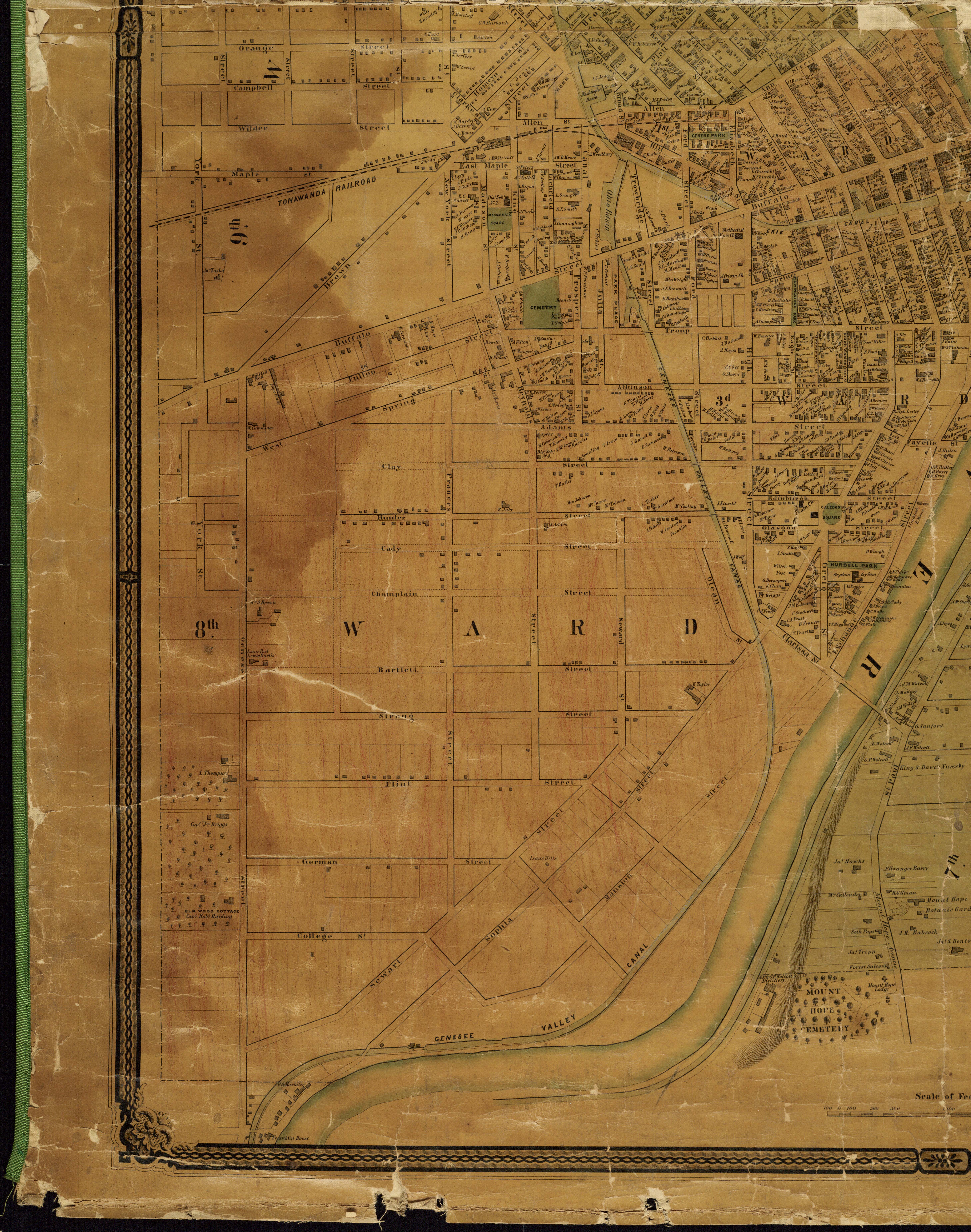
This one is slightly confusing at first; in the 1851 map of Centre Park, the name “J. B. Bennett” floats ominously amongst several dwellings; it’s not clear which one it’s indicating. The name is written between the Hunter home at No. 10 and the Angle house at No. 6:

Red: No.8/10 Centre Park, home of J. B. Bennett.
https://photo.libraryweb.org/rochimag/rpm/rpm00/rpm00446.jpg
The house begins as the home of Joel Barlow Bennett; at this time its address is No. 8.

https://www.libraryweb.org/rochcitydir/images/1851/1851a-c.pdf

Wednesday, March 09, 1881
https://www.newspapers.com/article/democrat-and-chronicle-joel-barlow-benne/171261160/
This segment of the article transitioning away from the Hunter house at No. 10 provides a clue: it says that the house was built by Joel V. Bennett. Making allowances for mistakes, this could easily be Joel B. Bennett:

Sunday, June 16, 1889
If that’s the case, that would make No. 8 Centre Park the house we know later as:
No. 6 Centre Park
Probably best known during its time as the home of James Lansing Angle, former Justice of the Supreme Court of New York.

Red: No. 6 Centre Park.
https://photo.libraryweb.org/rochimag/rpm/rpm00/rpm00127.jpg

https://photo.libraryweb.org/rochimag/rpm/rpm00/rpm00242.jpg

https://www.libraryweb.org/rochcitydir/images/1889/1889a-b.pdf
James L. Angle’s death was marked in the papers with a simply massive obituary, which I shan’t share here but is accessible on Page 9 of the May 5th, 1891 Democrat & Chronicle.

Grave of James L. Angle in Mt. Hope Cemetery.
https://www.findagrave.com/memorial/7811842/james-lansing-angle

No. 6 Centre Park.
https://www.loc.gov/resource/g3804rm.g3804rm_g06217189203/?sp=6&r=0.252,0.206,0.27,0.152,0
No. 4 Centre Park

Sunday, June 16, 1889
I hope you haven’t yet grown tired of attorneys, because No. 4 Centre Park was built by yet another one. Nicholas Emory Paine first is listed at his Centre Park address in the 1845 directory:

https://www.libraryweb.org/rochcitydir/images/1845/1845p-z.pdf
In 1848, his son Willis Seaver Paine would be born.
Nicholas E. Paine would serve as the 17th Mayor of Rochester between 1851-1852.


https://libraryweb.org/~rochhist/v26_1964/v26i1.pdf
Nicholas E. Paine would leave Rochester for New York City in 1868; Willis S. Paine would graduate from the University of Rochester that year and left with his father.

https://ldsgenealogy.com/books/cu31924092224322.pdf

Thursday, March 24, 1887
https://www.newspapers.com/article/democrat-and-chronicle-obituary-for-nich/171446717/
By 1875, No. 4 was the home of Oliver Marshall Cross, Sr. and his wife, Mary Jane Shelp.
Cross was a former worker dealer in leathers with his father, Austin Cross. This leather factory would become the Cross Brothers Company, leather tanners and dealers, with an eventual market in belting. The tannery was on the west side of the Genesee just south of the head of the Lower Falls, adjacent to the Deep Hollow ravine.
Oliver M. Cross, Sr.’s son Colin Wilson Cross would meet tall ships as they came down the Genesee to just near the present-day Driving Park Bridge. There, he would help unload tanbark and bring it to his grandfather’s tannery.

Red: The leather tannery of Oliver Marshall Cross at Lower Falls.
https://catalogplus.libraryweb.org/?section=resource&resourceid=1116704987
Oliver M. Cross moved into No. 4 Centre Park in 1869.

Red: No. 4 Centre Park.
https://photo.libraryweb.org/rochimag/rpm/rpm00/rpm00127.jpg
Mary Jane Shelp would die Febrary 19th, 1886.

Saturday, February 20, 1886
https://www.newspapers.com/article/democrat-and-chronicle-mary-jane-shelp-c/171261430/
By the next year, Oliver M. Cross would be remarried to the widow of Armina A. Holling, Mary J. Sheffield.
Which means the “Mary J. Cross” of the 1875 map and the “Mary J. Cross” of the 1888 map are actually two different Mary J. Crosses. How odd.

Red: No. 4 Centre Park.
https://photo.libraryweb.org/rochimag/rpm/rpm00/rpm00242.jpg

No. 4 Centre Park.
https://www.loc.gov/resource/g3804rm.g3804rm_g06217189203/?sp=6&r=0.289,0.264,0.258,0.123,0

Wednesday, September 19, 1900
https://www.newspapers.com/article/democrat-and-chronicle-obituary-for-oliv/171261552/

Graves of Oliver M. Cross and Mary J. Shelp in Mt. Hope Cemetery.
https://www.findagrave.com/memorial/33819889/mary-jane-cross
https://www.findagrave.com/memorial/156351992/oliver_marshall-cross


Wednesday, July 14, 2010
https://www.newspapers.com/article/democrat-and-chronicle-cross-bros-belti/171264951/
The Cross Bros. Company is now listed as permanently closed; it seems to have closed shop sometime around 2014.
So Long, Centre Park
Thus ends our 1889 tour of Centre Park, a neighborhood that was already old and only getting older. But the lives that kept the homes were going out one-by-one like lantern flames. Just like that, the residential spirit of the street was dying and being replaced with the brick edifices of industry.

Sunday, June 16, 1889
Centre Park in the 20th Century
Now that we’ve got a snapshot of the bucolic village street nearing the end of its heyday, what happened to it? How did life evolve on Centre Park after 1888, into the 20th century, up to its demise at the arrival of the Inner Loop?

https://photo.libraryweb.org/rochimag/rpm/rpm00/rpm00242.jpg
In 1899, the name of Moore Alley was changed to Bemis Alley.

https://photo.libraryweb.org/rochimag/rpm/rpm00/rpm00166.jpg
Between 1900 and 1910, two stone duplexes [dupleces?] were erected on the north side of Centre Park, become No. 8 Centre Park and No. 4½ Centre Park.

Red: New additions to Centre Park.
https://photo.libraryweb.org/rochimag/rpm/rpm00/rpm00278.jpg

Red: Henry Connolly Co., printers, No. 43 Elizabeth Street.
https://photo.libraryweb.org/rochimag/rpm/rpm00/rpm00339.jpg
As one can see from the map above, a large brick building for the Henry Conolly Co., a printing shop, has replaced the rambling old Bemis house formerly at No. 43 Elizabeth Street.

https://www.libraryweb.org/~digitized/serials/rochester_motorist/Rochester_motorist_1.pdf
In 1920, The Henry Connolly Company was granted a permit to expand their factory, resulting in the destruction of the two frame houses to its west: former Nos. 3 and 5 Centre Park, aka the Dickey and Burr houses.

Tuesday, February 03, 1920
https://www.newspapers.com/article/democrat-and-chronicle-henry-connolly-co/165338705/

https://mcnygenealogy.com/book/reveille-1928.pdf
This structure is still extant, at 39 Cascade Drive. Since then, it served as the offices of The Daily Record between 1969 and 2008, making it often known as “the old Daily Record building”.

No. 39 Cascade Drive.

https://photo.libraryweb.org/rochimag/rpm/rpm00/rpm00076.jpg
The former home of Jeremiah Tracy, former No. 11/51 Centre Park was purchased by the Multipost Co. sometime between 1918 and 1926; the frame house at No. 82 Oak Street was razed and the Multipost Co. factory was built onto the rear of brick No. 51 Centre Park.
In 1927, a new factory building for Multipost Co. was drawn up by architect Charles E. Lathrop and built on the site, whereupon the old brick house was likely destroyed.

Sunday, March 27, 1927
https://www.newspapers.com/article/democrat-and-chronicle-multipost-company/165417423/

http://photo.libraryweb.org/rochimag/rpm/rpm00/rpm00508.jpg
Major changes happen between 1935 and 1950:
-The Durand mansion at No. 12/60 Centre Park was torn down; in its stead a building for RJ Velepec Co., toolmakers, and inventors of the “screw holding” screwdriver.
-The venerable old brick Hunter house would finally succumb to the wreckers, to be replaced with two four-car parking garages.
-No. 7/31 Centre Park, the frame house of Jeremiah Cutler, came down.
-No. 9/41 Centre Park, the brick house of the Fenn family, came down.
Around 1944, the Dollinger Corporation moved into No. 11 Centre Park, previously the Connolly Company, and produced air filters. Dollinger Corp. was previously the Stay-New Filter Corp. at the corner of Leighton Avenue and Crouch Street.
A 1947 aerial taken by the Gannett Newspapers plane during a massive Industrial Street fire allows us a glimpse of the southwestern corner of Centre Park. One can see the former Multipost Company factory at lower left, and the Dollinger Corp. building at top left. The Caldwell Manufacturing building complex, where the fire took place, is center-bottom at the confluence of Bemis St., Oak St., and Industrial St. It has extensive damage.

Thursday, October 16, 1947
https://www.newspapers.com/article/democrat-and-chronicle-1947-centre-park/171465139/

https://www.loc.gov/resource/g3804rm.g3804rm_g06217195003/?sp=10&r=0.392,0.249,0.814,0.457,0
The barest glimpse of one of the Centre Street houses is provided in this photo of a fire, below. The burned building pictured was No. 14/12 Centre Park, originally No. 2 Centre Park, the old Shipman house:

Monday, January 11, 1965
https://www.newspapers.com/article/democrat-and-chronicle-centre-park-fire/165461160/

https://www.newspapers.com/article/democrat-and-chronicle-plant-slated-by-v/165421259/
Centre Square
Nearby Centre Park, between Fish Street [Center Street] and Ann Street [Allen Street], in the early 19th century, was a square of undeveloped land. Prior to 1844, the land was improved and laid out as a public park for the benefit of the surrounding neighborhoods.

Red: Centre Square.
https://www.loc.gov/resource/g3804r.ct005821/?r=0.196,0.295,0.314,0.177,0
In May of 1842, the cornerstone of a new school was laid at the north side of Centre Square. This would be the first School #5 building at the corner of Jones [Plymouth Avenue N.] and Fish [Commercial] Street.

Red: First #5 School building, corner Jones Ave. and Fish St.
https://photo.libraryweb.org/rochimag/rpm/rpm00/rpm00448.jpg
That roughly corresponds with a grassy patch outside the Innovative Field stadium:

Red: Former site of first #5 School building at Jones Ave. and Fish St.
Around 1844, however, a railroad connection between the Auburn & Rochester Railroad [to the east] and the Tonawanda Railroad [to the west] was being explored. This would provide a direct rail connection between Buffalo and Albany, a railroad that would go on to become the New York Central and all that came after that.
Unfortunately, this planned connection drove directly through Centre Square.


April 23, 1844

Red: Centre Square
https://photo.libraryweb.org/rochimag/rpm/rpm00/rpm00448.jpg
As feared by the locals, the railroad connection definitely destroyed Centre Square as a place of fresh air and tranquility. It became a dumping ground for excavated “soil” from construction projects and demolitions.


July 3rd, 1867
Red: Centre Square.
Green: Centre Park.
https://rochesterhistory.rit.edu/wp-content/uploads/2024/03/Rochester-Map-Medium-Res-1-1-scaled.jpg
What’s more, the Central Railroad connected their Niagara Falls run in Centre Square. By 1875 Centre Square was basically a railroad yard on a landfill.

Red: Centre Square.
https://photo.libraryweb.org/rochimag/rpm/rpm00/rpm00129.jpg

Red: Centre Square
https://www.loc.gov/resource/g3804r.pm006250/?r=0.783,0.484,0.136,0.082,0
In 1882, tons of noxious “soil” from the site of the first National Hotel was dumped in Centre Square. Rank and “oderous”, this stanky dirt caused a fuss with residents, who petitioned the Board of Health.

https://www.newspapers.com/article/democrat-and-chronicle-old-national-hote/165111369/

https://www.newspapers.com/article/democrat-and-chronicle-centre-square-mou/165090585/
Centre Park Station
After years of debate on the topic, it was finally decided to build the train station in Centre Park, to be creatively named Centre Park Station.

Saturday, June 09, 1888
https://www.newspapers.com/article/democrat-and-chronicle-center-park-stati/171305235/
Not quite a “solution” to the dumping problem, but building a train station there capped it off pretty nicely. I hope everyone enjoyed their park, while they had it!

Tuesday, December 18, 1888
https://www.newspapers.com/article/democrat-and-chronicle-center-park-stati/171305857/
The station was built very rapidly, with work commencing June 19th of 1888 and the station opening on December 17th of the same year.

Red: Centre Park Station
https://photo.libraryweb.org/rochimag/rpm/rpm00/rpm00242.jpg
The station’s signature was a steep set of stairs passengers were forced to scale in order to board or deboard their train. While this wasn’t an era especially well-known for its disability-friendly design, this was literally several steps beyond. I imagine this was no boon to the overburdened traveling lady or the cane-bearing older set, but to anyone wheelchair-bound this represented the citadel’s impregnable keep.

Center Park Station, looking northwest.
https://catalogplus.libraryweb.org/?section=resource&resourceid=1116704420
This depot would process thousands of passengers through the next forty-seven years. Ridership peaked in the 1920s, then began to plummet. By 1935 riders were a fraction of their usual rate, and the station was deemed redundant. The structure itself required enormous levels of maintenance and repairs, much of which was probably retreading those god-forsaken death stairs.

https://www.newspapers.com/article/democrat-and-chronicle-center-park-stati/165228211/
Come spring of 1935, the old station was being pulled down.

https://www.newspapers.com/article/democrat-and-chronicle-center-park-stati/29450485/
Check it out, you can see the Kodak Building to the left. That means the photo above roughly corresponds to this northeast view from the Inner Loop:

If one could get low enough, that is. The Inner Loop is much higher in the air than it would have been when this location was just Allen Street near North Washington Street.


https://www.newspapers.com/article/democrat-and-chronicle-center-park-stati/29450485/

https://www.newspapers.com/article/democrat-and-chronicle-howard-a-taft-c/165227532/
That little presidential fat joke was courtesy A. Whitman Crittenden. Take a bow, Mister Crittenden:


Red: rough location of Center Park Station.
Interestingly, there’s a teensy white sign–I presume it’s a mile marker–which gives a pretty good rough estimate of where the station used to stand. If you’re ever driving here, make sure to stare at that sign. What could go wrong?
The Centre Cannot Hold
And so we reach the common end of a common story; those lovely old houses full of life were destroyed. In their stead, either the stocky square structures of industry, or the asphalt expanse of highways and frontage roads. It’s amazing to think that a nucleus of Rochester qua Rochester was so easily extinguished, to the point where nobody would dream it was ever extant. Indeed, hammer “Centre Park” into Google Maps today and you’re greeted with

Centre Park.
To think, this was a charming, drowsy little gated street, a small petit-four sampling of village life, whose classic old houses weathered decades of Rochester’s awkward teenage years. All that, and it was honored by being swept from the map like yesterday’s lessons.
Yesterday’s lessons. Perhaps that’s all cities have to go off of, after all. We can’t bring back what we’ve squandered, but maybe we can keep what we do have into the next century, and beyond. It’s worth a try.
Supporting Gonechester
Did you enjoy what you read? Consider giving me a little tip at buymeacoffee.com/Gonechester, by way of saying “thanks!” It’s not necessary, but it certainly helps!








Leave a Reply